A Recent Trip
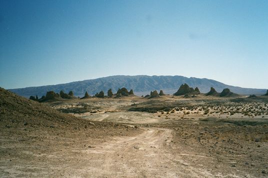 Having been up US 395 to the Eastern Sierra over twenty times, I always noticed on the way there several turn offs to Death Valley. And the last few times I have seen a turnoff to a town called Trona. So thusly by looking at a California map I started to think about a trip to the famous DV. This trip occurred on February 28th through March 2nd, 2002. The picture to the left is the Trona Pinnacles. They are just south of Trona.
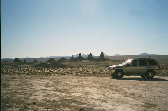 I planned a three day, two night trip to the area. By searching on the web I found some points of interest on the way. First would be Trona Pinnacles. The old TV series "Lost In Space" was filmed here. As was Star Trek V and the latest Planet of The Apes movie.
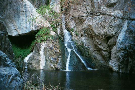 After visiting the Pinnacles, we went to see Darwin Falls by Panamint Springs. You start the hike to Darwin Falls at a dirt parking lot. The canyon is dry when you start out.
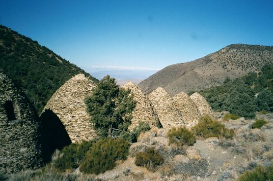 Then off to the Panamint range where the high point is Telescope Peak. Our plan was to spend the night at Wildrose Campground and climb Wildrose Peak the next day. So we found the campground and then went up the road to check out the charcoal kilns.
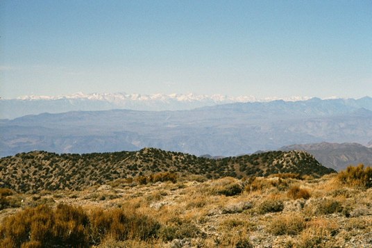
Off in the distance in the gap, you can see the Sierra Nevada mountains snowcapped. It looks like clouds but it's not.
Then off to the Panamint range where the high point is Telescope Peak. Our plan was to spend the night at Wildrose Campground and climb Wildrose Peak the next day. So we found the campground and then went up the road to check out the charcoal kilns.
Off in the distance in the gap, you can see the Sierra Nevada mountains snowcapped. It looks like clouds but it's not.
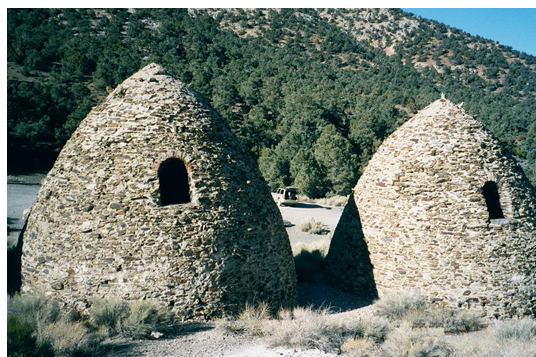 Of course to get to the trail you park by the charcoal kilns. Built in 1870 they are the best example of preserved charcoal kilns in the west. The charcoal produced from these was used for smelting ore. There are ten of these lined up in a row.
 The high country is covered with Juniper and Pinyon pines. If you have a vehicle with high clearance you can drive to two higher campgrounds. The upper one named Mahogany Flats has views of Death Valley.
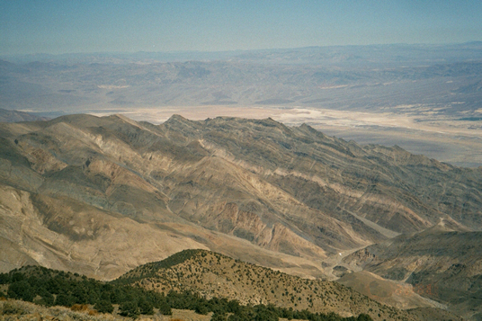
 Wildrose Peak is a 8.4 mile round trip. My buddy Matt wanted to climb Telescope Peak which is a fourteen mile round trip. But there was still quite a bit of snow on it since it was the beginning of March. This picture is a view from Wildrose Peak looking toward the Sierra Nevada.
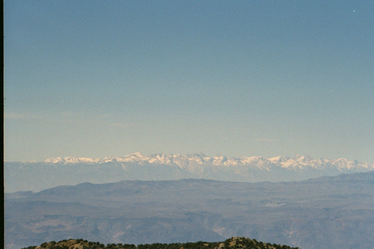 Another view from Wildrose Peak. In the middle of this photo is Mt. Whitney. It's the gray peak in the center. I believe in this photo that you can see from Olancha Peak in the south (left), up to Mt. Williamson and just north of it.
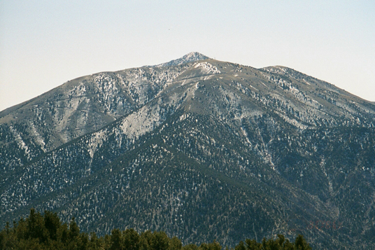 This is another view from on top of Wildrose Peak. You are looking towards Telescope Peak. It is the peak in the background. The mountain in the foreground with the road going up it is I believe Rogers Peak.
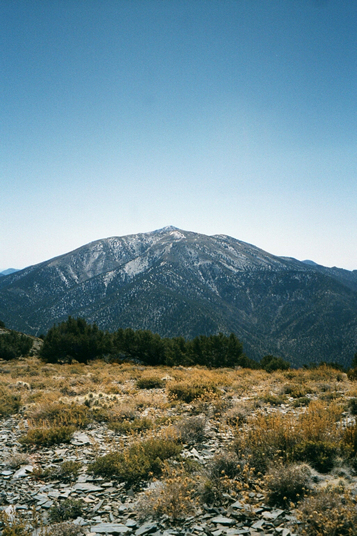 Another shot not zoomed in. Yes that is a little bit of snow up there since it's early March.
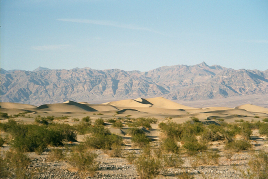 This is Stovepipe Wells dunes, on the way to the main valley. It was late afternoon and I did take this photo along with all the shots on this WWW page (ego,ego). It looks like a postcard to me.
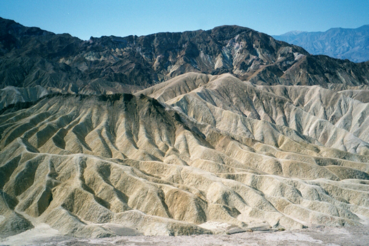 This is the view from Zabriskie Point. There is a movie named after this place. We had camped at Texas Spring campground the night before. The next day we went up highway 190 to see this and Dantes View.
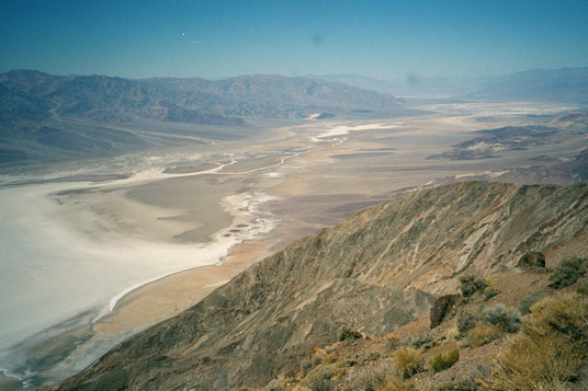 This is the view to the northwest from Dantes View. The valley below is Death Valley with Badwater being the white area to the left.
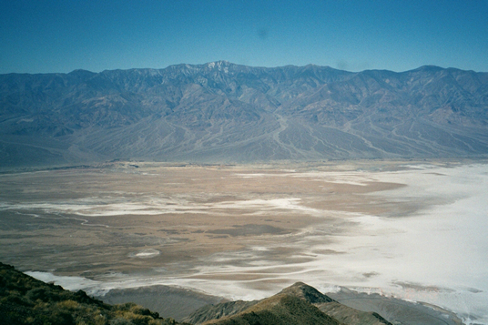 This view from Dantes is straight across the valley. The high point in the ridge is Telescope Peak and the peak on the far right is Wildrose. Great alluvium at the base of the mountain, eh? This is looking straight across Death Valley with Badwater below.
 Here is a shot from Devils Golf Course. What you see on the ground is salt crystals formed over time from drying in the extreme temperatures. Guess what peak that is with the snow on it?
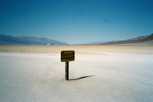 This is Badwater. This is the lowest elevation in the U.S. at -282 ft, -66 m. I guess in the old days people would be crossing the valley and find water but it was too brackish to drink. We were now on our way out of the valley headed south toward the town of Baker.
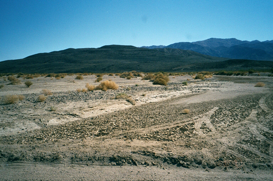 This is Shoreline Butte. See the lines up on the side of the bluff. Those are old water level lines from the ancient Manly Lake which at one time filled Death Valley. At this point we were starting to head east out of the park.
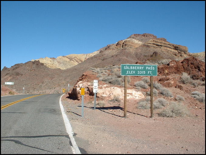 As the sign says this is Salsberry Pass. We are headed out of the park on highway 178. My buddy Matt took this photo with his camera. My shot of this did not turn out as well. Anyway if you've never been to Death Valley National Park, it
s worth taking a couple of days and driving through. Enjoy!
As the sign says this is Salsberry Pass. We are headed out of the park on highway 178. My buddy Matt took this photo with his camera. My shot of this did not turn out as well. Anyway if you've never been to Death Valley National Park, it
s worth taking a couple of days and driving through. Enjoy!